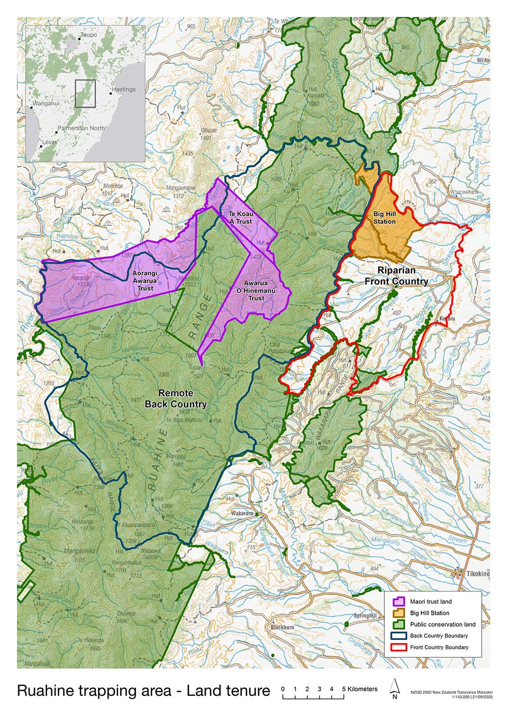


As part of the central spine of Te Ika a Māui, Te Pae Maunga o Ruahine heads South from a saddle on the Napier-Taihape Rd to the Manawatū Gorge. The total area of the Mauri Oho Project is 59,000ha in the Northern Ruahine Range. This comprises about 39,000ha on public conservation land and 7,000ha on Māori Trust Lands. The remaining 13,000ha is on streams running through neighbouring farmland in the Kererū district. Altogether the public conservation land and the Maōri Trust Lands constitute about half the total area of the Ruahine Range.